

Going to Work: On the Track
Hey, It’s Been 400 Years
How feasible is it, you may ask, to do this with any accuracy?
After 400 years, using an ancient map, a handful of clues from a journal, changes in terrain, how is it possible to speak of replacing and restoring markers “where Smith left the originals”?
The answer of course is to say with varying degrees of certainty.
First of all the map—a document of uncanny detail like none other in the 17th century. It has to be viewed from ground perspective, not aerial perspective. Do that and it opens like a treasure chest. It was pieced from several sheets of field notes, so it’s no surprise its scale varies from place to place.
With these allowances, the features of detail on it begin to fall into place and match what one sees even today.
The technique of rubber sheeting (laying a modern map over an old map) works on Grays Creek, Potomac River, Kuskarawaok. A careful assessment of journal clues leads one directly to Chesapeake. Teracosick and Gunters Harbour match modern features at a glance. What looks far might not be so far, especially east and west.
Siting along the so-called capture route uses the crude Zuniga map and requires much more pure speculation, and yet even there the sites make eminent terrain sense.
One thing hasn’t changed: the phases of the moon. Calculating tides for Smith’s progress around the Bay goes far to explaining where and how and how far.
Above all, after an intimate acquaintance with the map, a style emerges: If there is a fork and it’s not shown, it means that Smith turned around before he saw it. If there’s a bluff, he likes it. A riverbend will be where he stops. The result is we are confident nearly all our replacements are on firm footing within an acre of the originals.
False Accuracy?
Between latitudes 36 and 40, where we worked, a GPS reading of one second of arc equals 100 feet. A decimal of 1/10,000 of a degree equals 36 feet. That is as close as we chose to come.
A reading always represents the middle of a guess. Our certainties within uncertainty ranged from one acre to one mile, but the majority of guesses came closer to the the acre. Many locations “cried out” due to some prominence that answered to the Smith map or fulfilled several hints and details of the journal in combination with it or with modern maps.
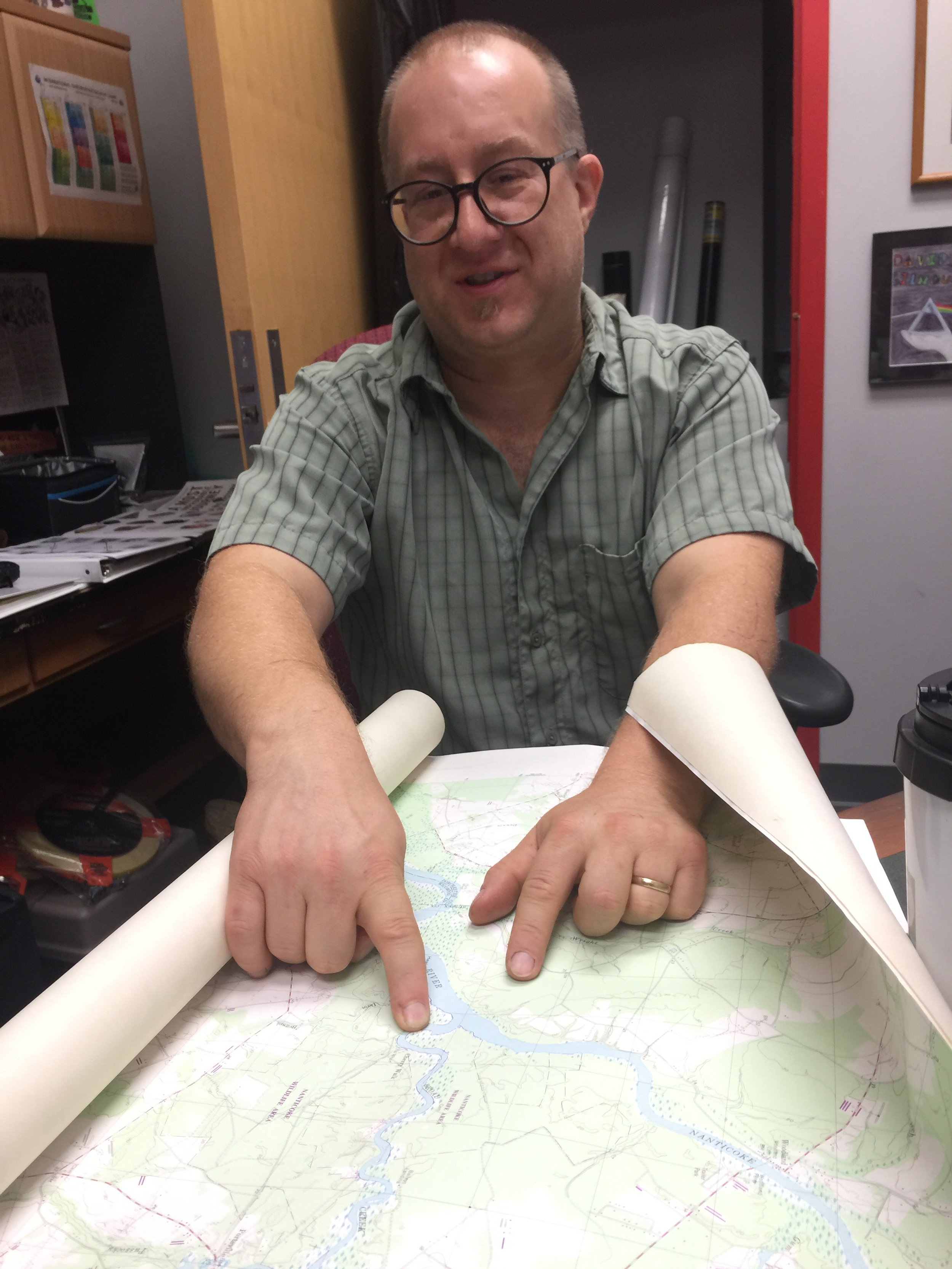
Here Dr. Brent Zaprowski, Professor of Geology and Geosciences at Salisbury University, points to Broad Creek on a modern topographic map. Broad Creek branches off the Nanticoke River in Delaware. Ed and Connie needed to explain its absence on the Smith map, which Dr. Zaprowski and his students helped us do using geological techniques such as LIDAR. (See “Kuskarawaok”)

Ed examines a copy of a portion of the Smith map on Government Island, Stafford County map. Here you can see Quiyough and Patawomeck in the white circle. The Smith map, along with his journals, are our primary source for the Captain John Smith Chesapeake Cross Markers.

Examining the Velasco map, 2016

The “Chesapeake” marker in Norfolk, VA, required an examination of land records in hopes of finding mention of an Indian town and following the land records trail of Ballentine Park. Above, Connie Lapallo at the Norfolk Public Library comparing records to the Smith map.

Maps and maps and maps and then … other maps.

We referenced the Velasco map as well as the Zuniga map in attempting to locate the cross marker sites on Smith’s map of Virginia.