
Captain John Smith’s Crosses
Crosses on the Smith Map
There are twenty-seven scattered over Smith’s map of the Chesapeake Bay under the title “Virginia, Discovered and Discribed.” The map has a legend, or key, in the upper right corner that presents a Maltese cross symbol (properly known as a cross formy or croix formée) and states, “Signification of these markes, To the crosses hath bin discoverd what beyond is by relation.”
The cross then represents the limit of Smith’s advance as an explorer of the Chesapeake. Up to the cross, Smith’s map is a firsthand representation of the Bay and tributaries. Upstream/upcountry of the crosses, he tells us information is secondhand, namely supplied by the local Indians.
… in which map observe this, that as far as you see the little crosses on rivers, mountains, or other places, have been discovered; the rest was had by information of the savages, and are set down according to their instructions. (A Map of Virginia, p. 10)
What Smith Tells Us about Leaving Crosses
He tells us in The General History, pp. 61–62,
In all those places and the furthest we came up the rivers, we cut in trees so many crosses as we would, and in many places made holes in trees wherein we writ notes, and in some places crosses of brasse to signifie to any [that] Englishmen had beene there.
and
… wee sayled so high as our boat would float, there setting up crosses and graving our names in the trees.
Mapped Exceptions
Exceptions are two crosses by the left margin of the map beside the names Mangoags and Chawons. We have no evidence Smith himself ever visited these Indian tribes near the modern Virginia-North Carolina line. They are the apparent result of two expeditions sent out of Jamestown in February and December 1608. We know for a fact Smith accompanied neither.
Another exception is a cross on the Atlantic coast shown to the left (south) of Cape Henry. Again, no evidence Smith ever went to this point. It might represent a sight boundary or landfall as a hummock or a sand dune, a feature perhaps to be seen by ships customarily approaching the Virginia capes from the West Indies.
Partial exceptions to the rule are four crosses on the Pamunkey and Mattaponi rivers, Moncuin Creek, and the Dragon Run, all associated with the Capture Route where Smith’s party forded or boated over water courses. They too represent, however, points beyond-which-no-further.
Have Any Been Found?
No original Smith cross has ever been identified. We have no description regarding size, origin, quantities, whether inscribed, how they were fixed in position, indeed nothing beyond the distinctive Maltese shape and the fact that Smith was carrying them around in quantity, hence they must have been small.
“Setting up” apparently means attaching to trees. From his statements, “We cut in trees so many crosses as we would” and further, “some places crosses of brass,” we would infer that several of either kind were left in each location.
A possible ready-made source of Smith’s crosses could have been the copper alloy pilgrim badges of Medieval England, lying obsolete since the Reformation in Britain’s cathedrals. One such appears to have turned up not too far from a mapped cross site. It was discovered in 2010 by Dr. Darrin Lowery during an archaeological survey along the east shoreline of Mockhorn Island (this would put it 3.6 miles southeast of our granite marker, 7. Mockhorn Bay). It was identified by Dr. Thomas E. Davidson of Jamestown Settlement as very similar to a pilgrim cross by bringing to light several English examples. Testing authenticated its age and content. As to a connection with Smith, the jury is still out.
Did Other Explorers Use Crosses?
The Portuguese explorer Diogo Cão in the 1480s erected crosses of the Order of Jesus along the coast of Africa from Gabon to Namibia in various rivers, bays, and headlands to signify the Portuguese claims. In the late 16th century the Spanish explorer Sarmiento de Gamboa set up large wooden crosses to guide mariners through the Chilean fjords and the Strait of Magellan. Capt. Christopher Newport in 1607 and Lord Delaware in 1610 set up crosses of this type on Cape Henry. All of these examples were large and prominent in order to signal passing ships.
As far as written notes and symbols carved in trees, that was standard procedure among land explorers from Samuel de Champlain to Lewis and Clark. Smith’s brass crosses, however, being mapped as well as being placed in the field, are a unique signature of Capt. Smith, a man we know of as a natural-born perfectionist and pedagogue.
The brass crosses likely belonged to Smith’s two expeditions up the Chesapeake in the summer of 1608. Elsewhere, such as ascending the James River with Newport in 1607 or on trading voyages in the James and York rivers or prospecting for a site to build “Smith’s” fort, tree bark and notes might have sufficed. It is hard to believe he had time or means for either while being frog-marched as Kekataw and Opechancanough’s captive, but Smith being Smith ….
Might Newport’s Two Crosses Be Mapped as Smith’s Crosses?
It is fair to ask if the two shown on Smith’s map above the “Falls” and near Cape Henry represent the ones that Newport and Delaware erected. It is always possible but unlikely.
They are incorrectly mapped for the same and Smith came to dislike Newport. We notice he did not move his “Falls” cross upstream to the end of Newport’s march of 1608 into Monacan country, though showing unidentified Newport’s route along the north bank.
Delaware’s cross of 1610 dates from the year following Smith’s departure from Virginia.
A good copy of the Mockhorn cross.
All photos: Connie Lapallo

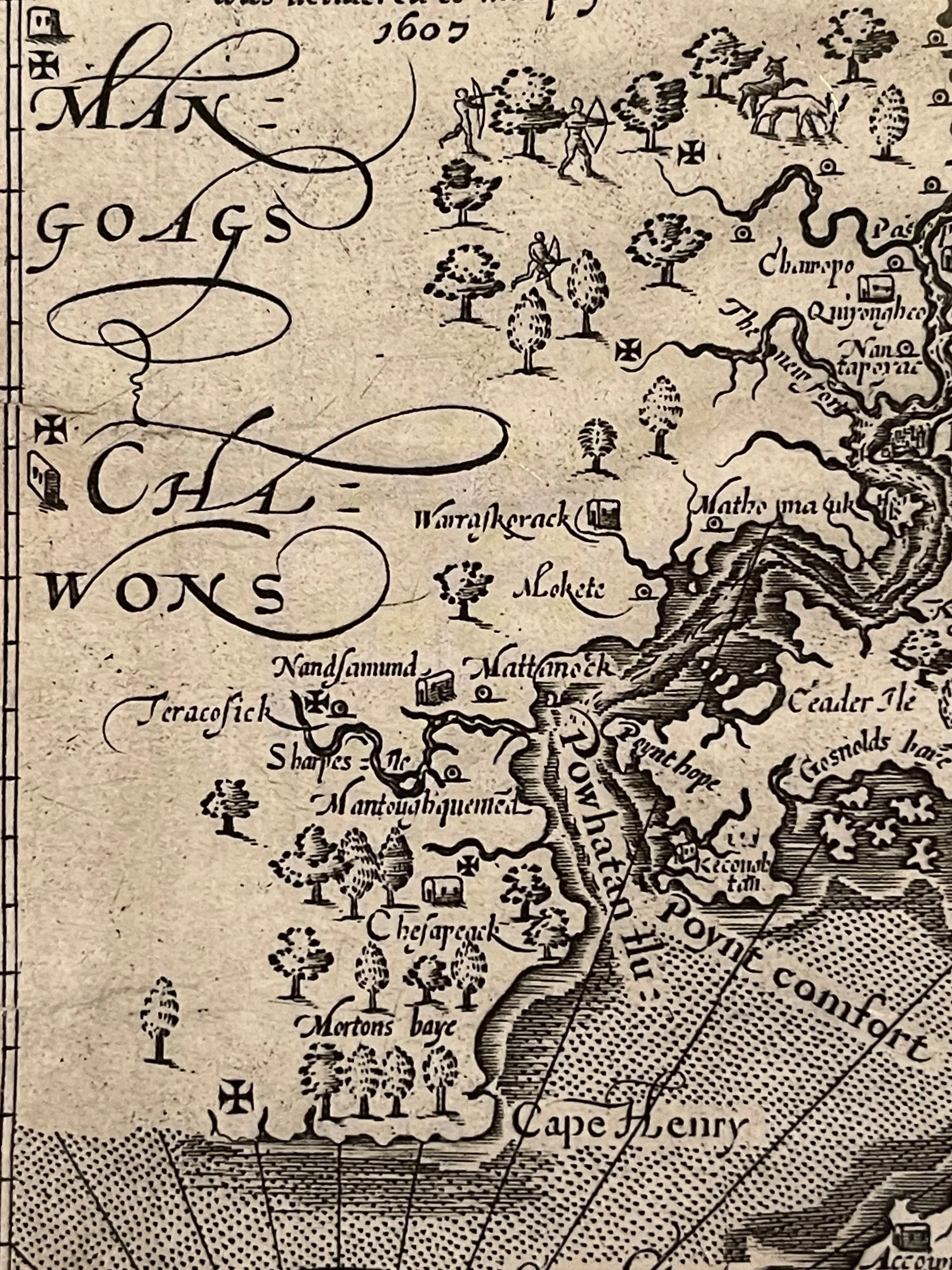
You can find five crosses on this portion of Smith’s map.
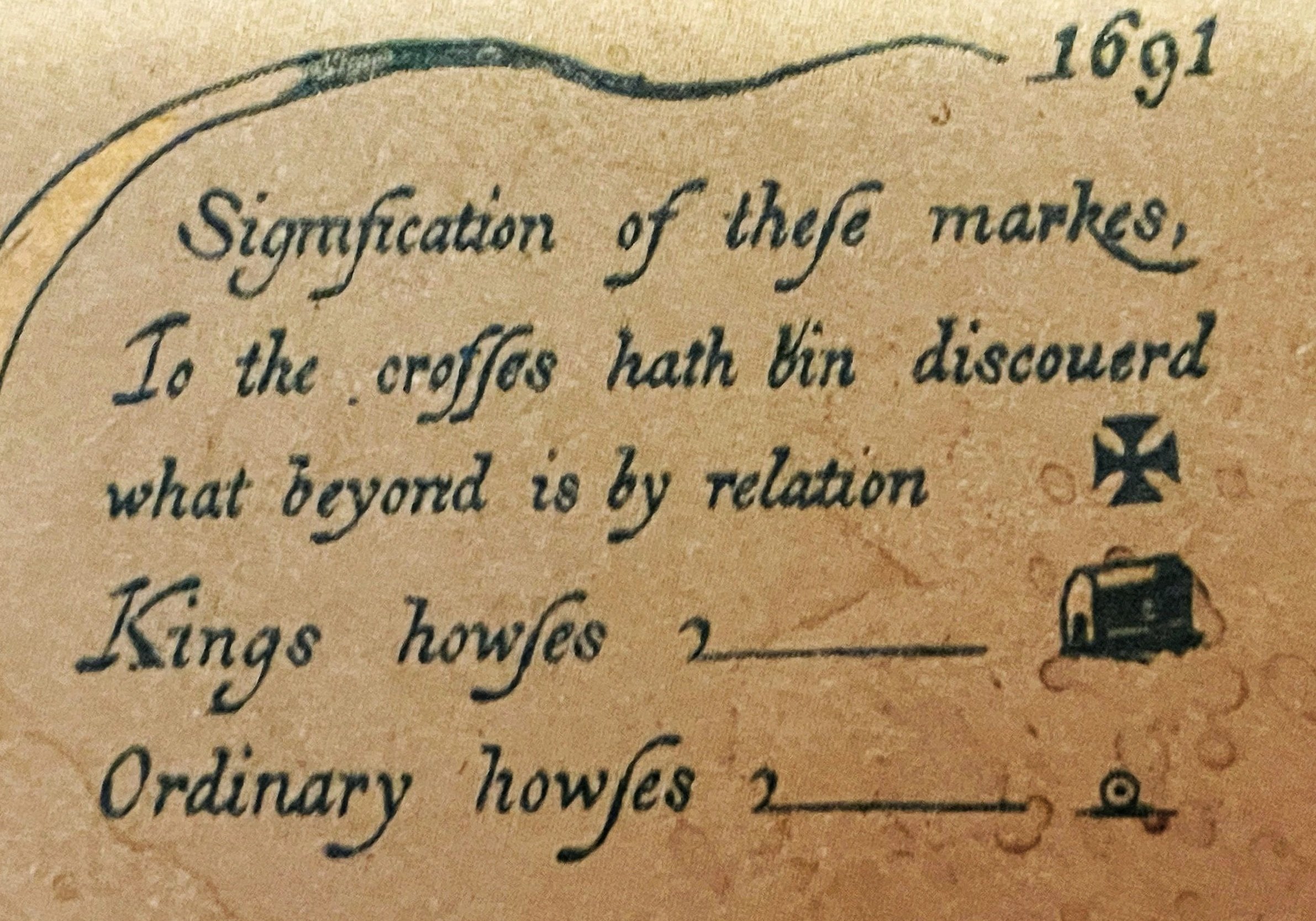
An enlargement of the legend from Smith’s Map of Virginia. (The number 1691 at the top is an extraneous page number, not a year.)
The three exceptions
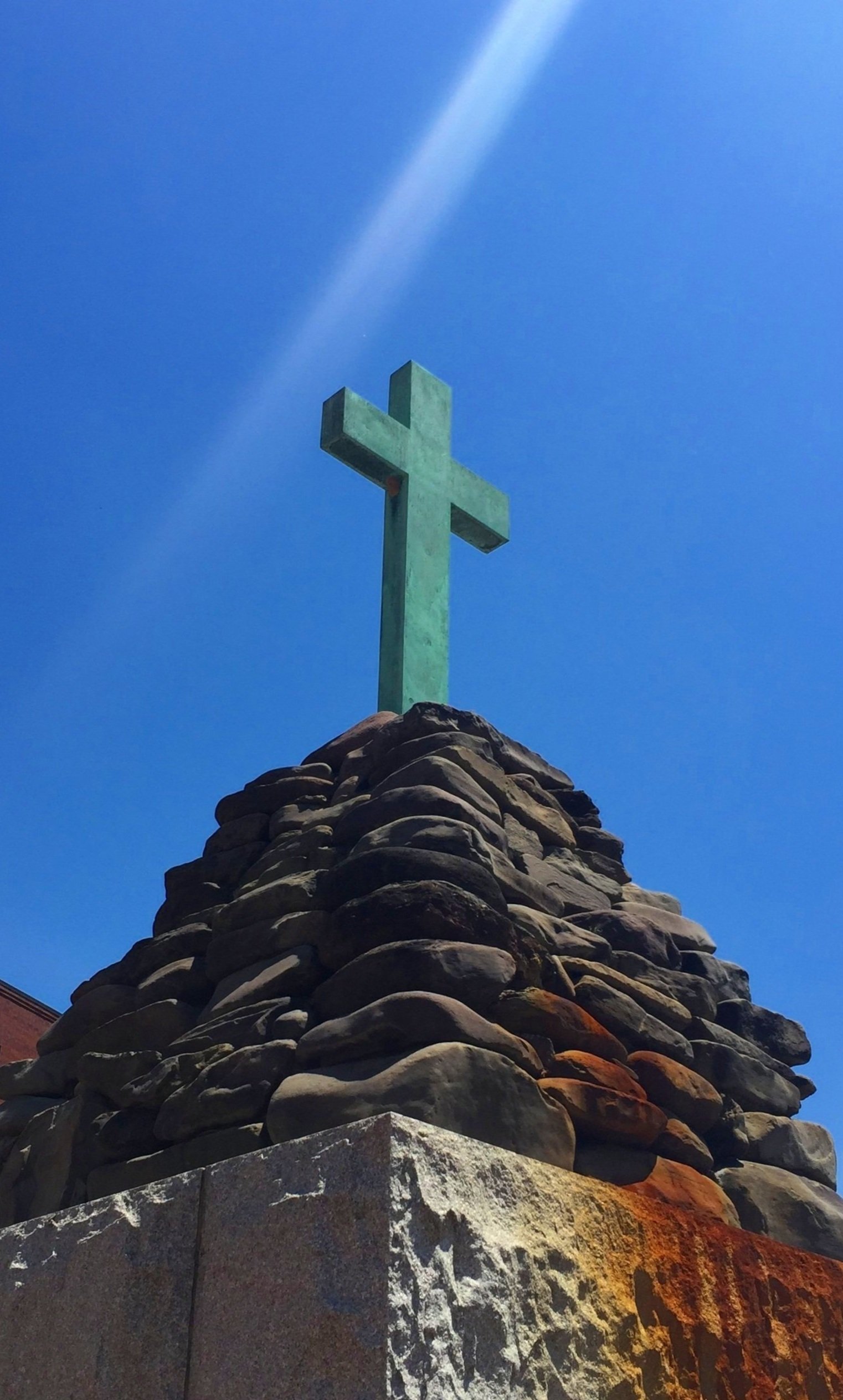
The Newport Cross Memorial in Richmond, Virginia, on 12th Street represents the large wooden cross that Captain Christopher Newport left behind apparently on today’s Mayo Island. There is a mate on Cape Henry inside Fort Story.

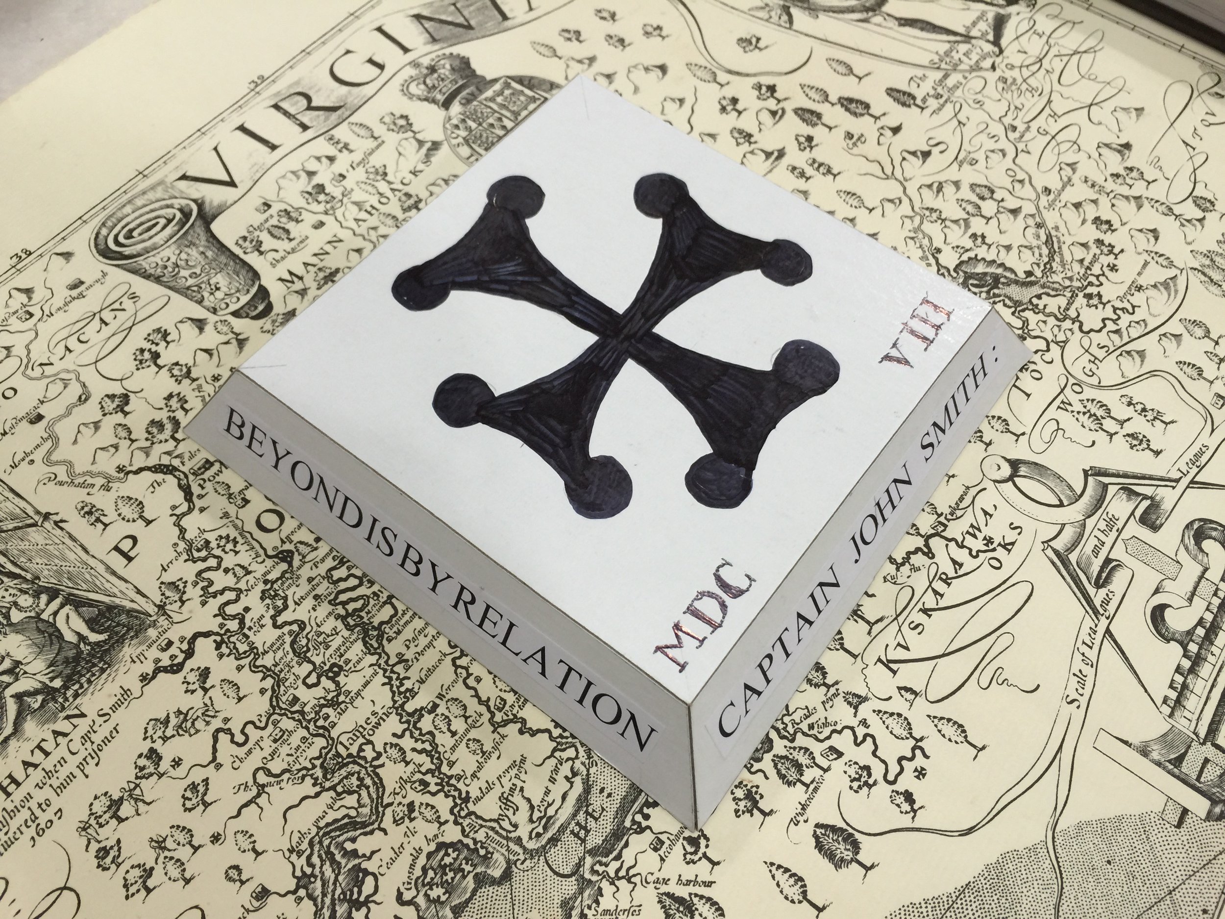
An actual Maltese cross

A cross formy. In popular parlance both styles are referred to as Maltese.