0
Skip to Content
Captain John Smith Chesapeake Cross Markers
ABOUT SMITH
SMITH'S WRITINGS
SMITH'S MAPS
Virginia Discovered and Discribed
Map of New England
OTHER JAMESTOWN MAPS
Zuniga Map
Velasco Map
Tindall Map
CONTROVERSIES
Three Turks
Pocahontas
Indian Policy
QUOTES
Colonial Justification
Colonization
Exploring & Mapmaking
Government
Indians
Judgments
Religion
Rumor
Slavery & Indenture
Virginia
War
Humor
SMITH'S WOMEN
THE EXPLORER
CAPTURE ROUTE
EPITAPH
SMITH'S CROSSES
RESTORING SMITH'S CROSSES
Chesapeake Cross Markers
Background
Going to Work: On the Track
FAQs
THE 24 SITES
Overview of 24 Sites
Sites on Modern & Smith Maps
Accuracy
Land Use
Accessibility
VISIT
1 - "The Falls" - Richmond, VA
2 - Moncuin Creek - Manquin, VA
3 - Mattaponi River - Aylett, VA
4 - Pamunkey River - Manquin, VA
5 - Dragon Run - Center Cross, VA
6 - "Teracosick" - Suffolk, VA
7 - Mockhorn Bay - Oyster, VA
8 - "Wighcocomico" - Pocomoke City, MD
9 - "Kuskarawaok" - Woodland, DE
10 - "Blands Content" - Elkridge, MD
11 - Potomac River - Seneca, MD
12 - "Burtons Mount" - Triangle, VA
13 - "Quiyough" - Stafford, VA
14 - "Smiths Falls" - Havre de Grace, MD
15 - "Gunters Harbour" - North East, MD
16 - "Peregryns Mount" - Newark, DE
17 - "Tockwogh" - Galena, MD
18 - "Willowbyes" - Perryman, MD
19 - Belmont - Falmouth, VA
20 - Fall Hill - Fredericksburg, VA
21 - "Chesapeake" - Norfolk, VA
22 - Upper Chippokes Creek - Prince George, VA
23 - "Appamatuck" - Colonial Heights, VA
24 - Grays Creek - Surry, VA
CRUISE ROUTES
ABOUT US
Cross Team
Our Books
TALKS
PRESS & CLIPPINGS
Links to Our Press
1996 - June 19 - Daily Press
SPECIAL THANKS
CONTACT
ABOUT SMITH
SMITH'S WRITINGS
Folder: SMITH'S MAPS
Back
Virginia Discovered and Discribed
Map of New England
Folder: OTHER JAMESTOWN MAPS
Back
Zuniga Map
Velasco Map
Tindall Map
Folder: CONTROVERSIES
Back
Three Turks
Pocahontas
Indian Policy
Folder: QUOTES
Back
Colonial Justification
Colonization
Exploring & Mapmaking
Government
Indians
Judgments
Religion
Rumor
Slavery & Indenture
Virginia
War
Humor
SMITH'S WOMEN
THE EXPLORER
CAPTURE ROUTE
EPITAPH
SMITH'S CROSSES
Folder: RESTORING SMITH'S CROSSES
Back
Chesapeake Cross Markers
Background
Going to Work: On the Track
FAQs
Folder: THE 24 SITES
Back
Overview of 24 Sites
Sites on Modern & Smith Maps
Accuracy
Land Use
Accessibility
Folder: VISIT
Back
1 - "The Falls" - Richmond, VA
2 - Moncuin Creek - Manquin, VA
3 - Mattaponi River - Aylett, VA
4 - Pamunkey River - Manquin, VA
5 - Dragon Run - Center Cross, VA
6 - "Teracosick" - Suffolk, VA
7 - Mockhorn Bay - Oyster, VA
8 - "Wighcocomico" - Pocomoke City, MD
9 - "Kuskarawaok" - Woodland, DE
10 - "Blands Content" - Elkridge, MD
11 - Potomac River - Seneca, MD
12 - "Burtons Mount" - Triangle, VA
13 - "Quiyough" - Stafford, VA
14 - "Smiths Falls" - Havre de Grace, MD
15 - "Gunters Harbour" - North East, MD
16 - "Peregryns Mount" - Newark, DE
17 - "Tockwogh" - Galena, MD
18 - "Willowbyes" - Perryman, MD
19 - Belmont - Falmouth, VA
20 - Fall Hill - Fredericksburg, VA
21 - "Chesapeake" - Norfolk, VA
22 - Upper Chippokes Creek - Prince George, VA
23 - "Appamatuck" - Colonial Heights, VA
24 - Grays Creek - Surry, VA
CRUISE ROUTES
Folder: ABOUT US
Back
Cross Team
Our Books
TALKS
Folder: PRESS & CLIPPINGS
Back
Links to Our Press
1996 - June 19 - Daily Press
SPECIAL THANKS
CONTACT
A glimpse of the wide and beautiful Potomac River, Smith's best hope for the Northwest passage View fullsize

A glimpse of the wide and beautiful Potomac River, Smith's best hope for the Northwest passage

The landscape surrounding the marker on Northeast Creek, barren in winter, is nearly impassable with tearthumb in summer. View fullsize

The landscape surrounding the marker on Northeast Creek, barren in winter, is nearly impassable with tearthumb in summer.

ZOAR.jpg View fullsize
How do you design a granite marker? Start with cardboard and draw a design to be engraved, maybe? Ed created this early prototype. View fullsize

How do you design a granite marker? Start with cardboard and draw a design to be engraved, maybe? Ed created this early prototype.

A view of the Chesapeake Bay from the bridge. It's stunning, blue, expansive. View fullsize

A view of the Chesapeake Bay from the bridge. It's stunning, blue, expansive.

How does Smith's representation of the Potomac River compare to the modern topographic map? View fullsize

How does Smith's representation of the Potomac River compare to the modern topographic map?

JAMES RIVER - Sunset 3.JPG View fullsize
Part of the Smith map View fullsize

Part of the Smith map

The serene Sassafras (Toghwogh) River on Maryland's Eastern Shore. View fullsize

The serene Sassafras (Toghwogh) River on Maryland's Eastern Shore.

The James River is beautiful. We like to imagine how it looked to the settlers. View fullsize

The James River is beautiful. We like to imagine how it looked to the settlers.

We're in a small boat near the mouth of the Bush River so that we can see it as Smith did. View fullsize

We're in a small boat near the mouth of the Bush River so that we can see it as Smith did.

BAY off Bush River selfie.JPG View fullsize
The Elizabeth River in downtown Norfolk. We concluded Smith had placed a marker on the little Lafayette River rather than the mighty Elizabeth. View fullsize

The Elizabeth River in downtown Norfolk. We concluded Smith had placed a marker on the little Lafayette River rather than the mighty Elizabeth.

BAY - Fishermans Island 2.JPG View fullsize
CHICKAHOMINY River - foggy.JPG View fullsize
The Chickahominy River iced over in 2018 gives some idea of life in Colonial Virginia during the Little Ice Age. The Jamestown settlers described the James River frozen into a block of ice. View fullsize

The Chickahominy River iced over in 2018 gives some idea of life in Colonial Virginia during the Little Ice Age. The Jamestown settlers described the James River frozen into a block of ice.

The replica ship Discovery docked at the old channel of the James River. In 1611, the colonists created the new town of Henricus on the bluff above. In the earlier days of 1607, Smith, on Capt. Christopher Newport's 1607 expedition, would have taken View fullsize

The replica ship Discovery docked at the old channel of the James River. In 1611, the colonists created the new town of Henricus on the bluff above. In the earlier days of 1607, Smith, on Capt. Christopher Newport's 1607 expedition, would have taken the original channel to the left in traveling upriver.

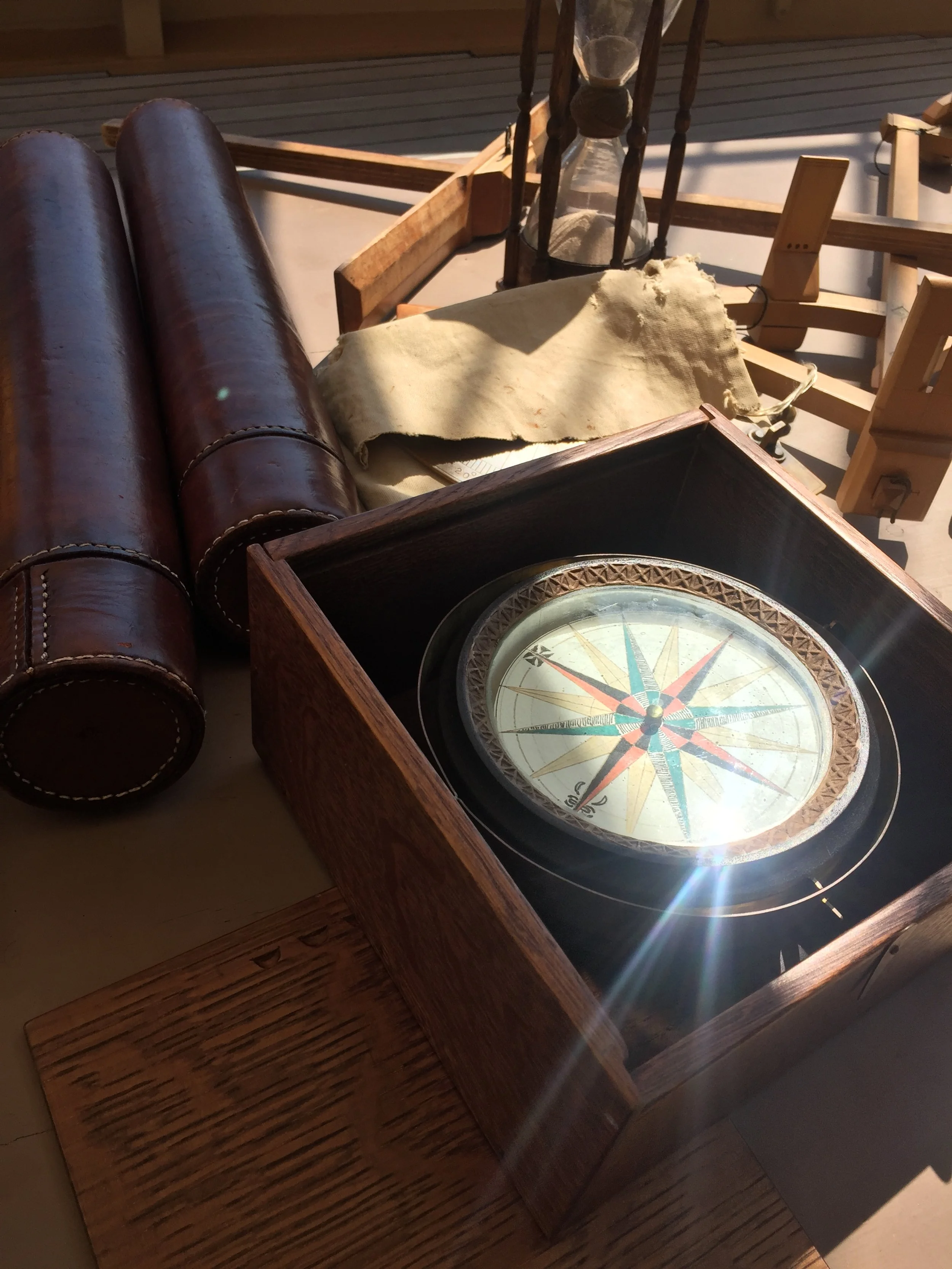
A look at navigation instruments of Smith's day aboard the Discovery. View fullsize

A look at navigation instruments of Smith's day aboard the Discovery.

Another boat ride, this one on the James River and on Chippokes Creek to view the landscape as Smith did. View fullsize

Another boat ride, this one on the James River and on Chippokes Creek to view the landscape as Smith did.

IMG_6520 (1).JPG View fullsize
Ed looking into toward the Chesapeake Bay near the mouth of the Bush River. Surveying by water as well as land helps us view the landscape as Smith did from his shallop. View fullsize

Ed looking into toward the Chesapeake Bay near the mouth of the Bush River. Surveying by water as well as land helps us view the landscape as Smith did from his shallop.

The granite marker before being planted in the ground. View fullsize

The granite marker before being planted in the ground.

A glimpse of the wide and beautiful Potomac River, Smith's best hope for the Northwest passage
The landscape surrounding the marker on Northeast Creek, barren in winter, is nearly impassable with tearthumb in summer.
ZOAR.jpg
How do you design a granite marker? Start with cardboard and draw a design to be engraved, maybe? Ed created this early prototype.
A view of the Chesapeake Bay from the bridge. It's stunning, blue, expansive.
How does Smith's representation of the Potomac River compare to the modern topographic map?
JAMES RIVER - Sunset 3.JPG
Part of the Smith map
The serene Sassafras (Toghwogh) River on Maryland's Eastern Shore.
The James River is beautiful. We like to imagine how it looked to the settlers.
We're in a small boat near the mouth of the Bush River so that we can see it as Smith did.
BAY off Bush River selfie.JPG
The Elizabeth River in downtown Norfolk. We concluded Smith had placed a marker on the little Lafayette River rather than the mighty Elizabeth.
BAY - Fishermans Island 2.JPG
CHICKAHOMINY River - foggy.JPG
The Chickahominy River iced over in 2018 gives some idea of life in Colonial Virginia during the Little Ice Age. The Jamestown settlers described the James River frozen into a block of ice.
The replica ship Discovery docked at the old channel of the James River. In 1611, the colonists created the new town of Henricus on the bluff above. In the earlier days of 1607, Smith, on Capt. Christopher Newport's 1607 expedition, would have taken
A look at navigation instruments of Smith's day aboard the Discovery.
Another boat ride, this one on the James River and on Chippokes Creek to view the landscape as Smith did.
IMG_6520 (1).JPG
Ed looking into toward the Chesapeake Bay near the mouth of the Bush River. Surveying by water as well as land helps us view the landscape as Smith did from his shallop.
The granite marker before being planted in the ground.

Captain John Smith


“Your’s to use.” John Smith’s autograph on his letter to the cordwainers.